Using Technology to Better Serve Our Communities
This month Western City focuses on technology, and some exciting things are happening in this area. Many California cities are looking at ways to put the Internet of Things to work in serving the public. Writer Jacob Morgan offered this definition of the Internet of Things in a May 13, 2014, Forbes article:
Simply put, this is the concept of basically connecting any device with an on and off switch to the Internet (and/or to each other). This includes everything from cellphones, coffee makers, washing machines, headphones, lamps, wearable devices and almost anything else you can think of … if it has an on and off switch then chances are it can be a part of the Internet of Things … The Internet of Things is a giant network of connected “things” (which also includes people).
Many of us already experience the Internet of Things in our households with the ability to handle many tasks remotely, such as lock and unlock doors, turn lights on and off, set an alarm system or open the garage door.

In my city, Rancho Cucamonga, we are asking ourselves how we can make more use of technology in serving the public — and how that intersects with the Internet of Things. For example, what if streetlights had multiple uses? In addition to lighting the streets, they could perhaps be used as signal beacons to report incidents or they could self-report when the light stops working and needs replacing.
If there are no boundaries to the functionality of our infrastructure, what might we envision? Another possibility is using some type of metrics along fire hydrant lines to alert city staff to a problem, whether it’s a mechanical failure or vandalism causing a malfunction. The Internet of Things holds great promise for essential community services.
Innovative Ways to Show Data and Engage Residents
Most cities have a great deal of available geospatial data, which historically has been used in engineering and planning. But that data presents some intriguing opportunities when considering ways to optimize services. By putting the data into an easy-to-understand format, you can potentially turn the least engaged city resident into a very engaged person. Geographic information systems (GIS) data can be repackaged in a way that makes the information readily accessible. For example, data that shows all responses, such as police, fire and public works, in a map format could be useful for residents, business owners and city staff.
When people see a map of where they live or work, it stimulates their interest in their neighborhood and community, and the map can link them with additional city-related information, services or social media.
Telling City Stories in a New Way
Bedroom communities, such as Rancho Cucamonga, can be challenging to engage. We are exploring the use of story maps, which present a set of images related to GIS data, to capture the interest of residents. One project currently underway in Rancho Cucamonga uses story maps for public artworks projects and shows the connectedness of public art projects. People can learn more about public art throughout the city by using the online and mobile-optimized story maps, which complement walking tours.
Efforts like these can help drive community members who weren’t previously involved in city matters to become interested in what the city has to offer. Story maps provide a way to showcase many city features, such as historical community resources and more.
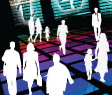
Cities are continually exploring ways to serve community members on multiple levels — whether they need assistance at the City Hall front counter or a mobile app for quick inquiries, online applications, permits and so forth. New technologies are helping bring City Hall services to those who seek them.

Innovative Solutions to Public Safety Challenges
Rancho Cucamonga is also in the early stages of using a relatively new technology — drones — to help address the long-standing public safety issue of lost and injured hikers in the Cucamonga Canyon and surrounding areas in the region. The terrain can be dangerous, and hikers can easily become lost or injured. Even if they are in an area with cellphone service, there are often no identifying landmarks that they can use to help rescue personnel locate them. Finding them can be a slow, cumbersome and labor-intensive task.
We looked at the types of information a drone can uniquely acquire in such a situation and how a drone that transmits real-time video could improve our ability to respond.
To get this project started, the city applied for a license from the Federal Aviation Authority (FAA), which licenses public aircraft operations (www.faa.gov/uas/public_operations). The FAA asks the applicant agency to provide details on the geographic and mission parameters. In our case, Ontario Airport is located 5 miles south of the city, so air traffic concerns play a major role in using these drones.
The drone project will use high-definition and night-vision (thermal imaging) reconnaissance to locate lost and/or injured hikers. Licensed pilots will operate two drones — one is a mission drone and the other is a training drone, which is less expensive to replace. This drone service will be available to the Fire Department 24/7.
At this time, the only option in most cases is to send a helicopter to search for the lost or injured people. In many cases, once they are located, there is a delay between finding them and getting the needed services to them, depending on the amount of assistance, support and personnel required. We anticipate that by using drones, we will be better equipped to find lost or injured individuals and evaluate which services are needed — and ultimately get help to them much faster.
The drones’ thermal imaging capability also presents exciting possibilities related to real-time mapping for wildfires. Thermal imaging provides information on “hot spot” areas so that city officials and public safety staff can safely evacuate a neighborhood when a fire threatens. Rancho Cucamonga is examining ways to send video from the drones to the Emergency Operations Center during wildfires.
Looking to the Future
These are just a few examples of how technology can help cities reach out to and support our communities. I encourage you to explore the new opportunities provided by technology and creative thinking. Talk to your residents and local businesses about what they need and how the city can best connect them with information and services, and invite city staff to brainstorm how technology can help better serve the public. The possibilities are limitless.
Photo credits: Sue Leonard Photography/Shutterstock.com (fire hydrant); PhotoSerg/Shutterstock.com (street lights)
This article appears in the February 2016 issue of
Western City
Did you like what you read here? Subscribe to Western City